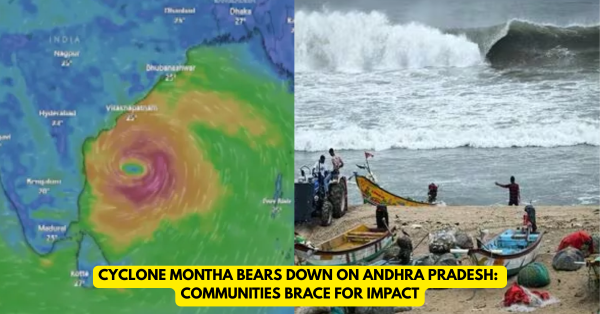
India — A potent cyclonic storm is inching closer to India’s east coast, with authorities in Andhra Pradesh issuing full-scale warnings and mobilising disaster teams as Cyclone Montha approaches with sustained winds of nearly 100 km/h and gusts higher. The storm is expected to make landfall between Machilipatnam and Kalingapatnam — a vulnerable stretch of coastline — by late evening or early tomorrow morning.
Coastal Alarm Bells Ring
In response to the impending threat, the state government has placed 19 coastal and nearby districts under red alert. Evacuations are underway, schools and colleges have been suspended, and public advisories warn residents to remain indoors and avoid travel.
Preparation in Full Swing
- Hundreds of relief camps and shelters across the region are being readied.
- Emergency response teams from the National Disaster Response Force (NDRF) and state disaster services have been deployed to high-risk zones.
- Coastal residents and fishing communities have been advised to remain ashore and stay away from the sea as sea-state and storm surge risks rise sharply.
Risks Mount as Crops and Lives Hang in the Balance
Beyond the immediate threat to life and infrastructure, the storm looms large over the livelihoods of millions: Agriculture officials estimate that more than 6 lakh hectares of paddy, cotton and other crops may be affected in Andhra Pradesh alone if the storm’s heavy rains and winds arrive as predicted.
Local farmers in Krishna, Godavari and Bapatla districts have begun taking last-minute precautionary steps — draining fields, covering vulnerable seedlings, and moving equipment to higher ground. The mood is tense. As one farmer put it: “We are used to the rains, but not the uncertainty of when the skies will break and whether we will lose everything.”
The Storm’s Path and What to Expect
Meteorologists are tracking Montha’s movement closely. Currently centred over the west-central Bay of Bengal, it is moving north-northwest at around 12–15 km/h and continuing to gain strength. Landfall is estimated for later today or tonight, with the worst of winds and rainfall expected in immediate coastal zones and then inland over the following 24–48 hours.
Residents in low-lying and flood-prone villages, particularly in mandals around Kakinada and Konaseema, are on high alert for storm surge, inundation and strong gusts that could uproot trees, damage power lines and collapse poorly built homes. Evacuations are being prioritised for pregnant women, children and the elderly.
Community Impact and Urgent Advice
For the thousands moving to shelters, the message is clear: pack essentials, charge devices, stay tuned to updates and follow official instructions. Families boarding buses or sea-boats to safety face the anxiety of leaving homes behind, uncertain when they’ll return.
The most vulnerable — daily wage workers, coastal fisherfolk, elderly residents — are the ones bearing the brunt of uncertainty. Flooding of roads, lost income, power outages and disruption of communication are what many fear more than just the storm itself.
Governments across the three potentially impacted states — Andhra Pradesh, Odisha and Tamil Nadu — have issued multi-tier warnings and stand-by support. But the reality on the ground remains fragile: Even as evacuations proceed, structural vulnerabilities remain, especially in rural settlements built close to the coastline.